An alpine hiking challenge in the mountains around Wells, BC.
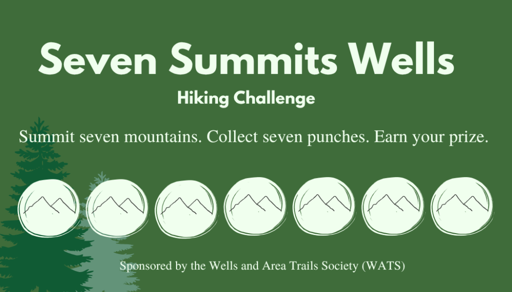
The Wells Seven Summits is a hiking challenge located in the area around Wells, British Columbia.
Complete seven summits over the course of the summer to get a fun pin and bragging rights!
Skip to: Island | Agnes | Slide | Murray | Patchett | Magnus | Two Sisters | Tinsdale | Guyet | Burdett
Choose your own adventure
There are ten summits around Wells with tins and punches. Find the tins on each summit and punch your card as proof.
It’s kind of like a coffee punch card. Reach seven different summits, collect seven punches, get bragging rights and a sweet pin!
Grab a punch card at the Frog on the Bog gift shop, in a summit tin, or by contacting us directly.
Use the hashtag #7summitswells on social media to share your photos with our hiking community.
Safety first! Fun, a close second.
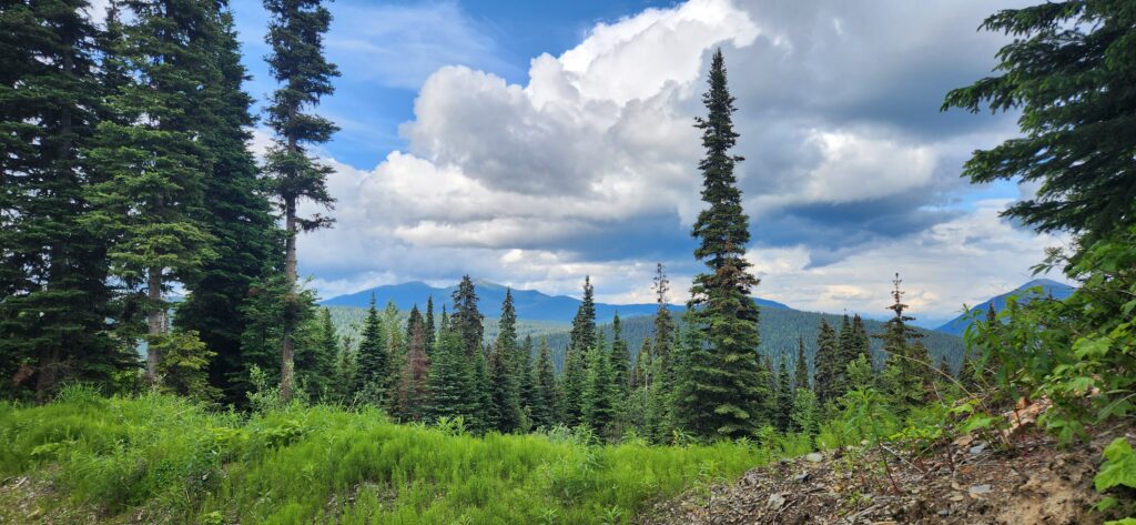
The wilderness is beautiful and easily accessible from Wells, but please come prepared for the possibility of encountering wildlife, changing weather conditions, and lack of cell phone coverage. Check the weather forecast and BC Wildfire Service to know the conditions before you go. Always bring rain gear, a warm hat, and sturdy shoes or hiking boots. It can get quite chilly on the summits, and you will often encounter a bit of snow even into July!
You can buy bear spray and bells at the Frog on the Bog giftshop.
Difficulty
The difficulty level of these hikes vaires from easy to moderate. The shortest hike is about 1.5 hours round trip, while the longest ones can be up to 5-7 hours.
We recommend starting with Island Mountain or Mount Agnes first and progressing from there. However, the joy of this Hiking Challenge is you can do it in any order and at your own pace.
Many of the recommended hiking routes are described in Hiking in the Cariboo Goldfields by Edwards, Funk and Stoker and in Central Interior Hiking Guide Vol 1 by Dave King and Bob Nelson.
Do you GEOCACHE? Many of the summits are also geocaches!
What else is in Wells?
Grab a pre-hike snack at the Jack O’ Clubs General Store or BNC Mercantile. Stock up on bear spray and mosquito repellant at the Frog on the Bog gift shop.
Need dinner before heading home? Wells and Barkerville have amazing restaurants to refuel after a long hike. Or stay overnight at one of our hotels, vacation rentals or BnBs. What’s Up in Wells has all the information you need to find food, shopping and overnight stays.
If you’re staying for a few days, make sure you check out Barkerville Historic Town & Park, which is also the gateway to the Mount Agnes trail head.
Finished?
Contact us for your pin.
We are working to add more maps and information over the coming weeks, so stay tuned!
KMZ files
See our shared Google Drive folder for all available KMZ/KML files: Seven Summits Maps
Summit #1 – Island Mountain
Trailhead: If you’re heading into Wells, take the first left on Pooley Street. At the museum, turn left onto Burnette Ave. Take your first left on Davies, and follow it up for a few minutes until you get to the gate (trailhead).
Distance: 7km roundtrip (~1.5-2 hours)
Map: Island Mountain (Google Maps) | Island Mountain (KMZ file)
Summit #2 – Mount Agnes
Trailhead: At the end of the main road in Barkerville, head towards the Richfield courthouse and take the Cariboo Waggon road uphill towards Summit Rock.
Distance: 17km roundtrip (~3-4 hours). Elevation 410m (1350 ft).
Tin: At the cairn at the summit of Agnes, above Groundhog Lake. Best reached by the left side path after the cabin.
Tip: Grab dinner or a bite from the Barkerville Bakery on your way back!
Summit #3 – Slide Mountain
Trailhead: Head 10km down the Bowron Lake Road. If you see the avalanche gates, you just passed the trailhead. There is a pullout and sign in the trees.
Distance: 8km roundtrip (~3-4 hours)
Tin: At the second antenna tower
Maps: Slide Mountain (Google Maps) | Trailhead (Google Maps) | Slide (KMZ File) | Slide Trailhead (KMZ file) | Slide Mountain traverse (Murray to Slide, KML only)
Summit #4 – Two Sisters
Trailhead: Head 17km down Bowron Lake Road, then turn left at the 2400 road (at 2476). . The trailhead is about 4 km down and there is a sign for parking.
Distance: 15km round trip
Tin: The punch-tin is on the South Sister. The North Sister has the Lookout shelter. The final 500m to the south summit is a Class 2 scramble (meaning you need your hands and there is some exposure). However, there is a ‘low’ route that keeps you away from the edge, if you are uncomfortable, or the weather demands caution.
Dave J’s Alternatives Two Sisters Routes :
Approach: Take the Bowron Road to the 2400 rd. Unusually, you enter the 2400 at 2476 but as you drive in, the numbers count down. 4 km in at 2472 there is a sign for parking below the road. However, there is parking for two cars at the trailhead itself 500 m ahead. Use your discretion depending on whether there is logging activity in the area.
Trail: There is a steep gravel road all the way to the summit of the North Sister, where there is an old ‘fire lookout’ that serves as an emergency shelter. The Seven Summits cairn is on the South Sister, a km or so away. There are many variations in the hikes here, including three variations through the meadows, a ridge-walk down the East ridge of the North Summit, before dropping down to the road, or a simple road walk. If you follow the road, then .5 km before turning right to climb to the shelter, you leave the road and walk down through the col to the South Summit. Note that this road is also an ORV route so it is possible to meet vehicles all the way to the North Summit.
The trail description below is for a meadow walk that takes advantage of lush meadows and alpine flowers instead of walking almost the whole distance on cobble.
From the trailhead, walk up the road past a small switchback at 2.3 km until you arrive at a big switchback at 3.3. Follow the flags straight off the road and prepare to be delighted. The trail rounds behind a plywood storage shelter of unknown origin. Flagging brings you uphill to a broad meadow with a very small creek, which you follow to the top of the meadow and then swing left 80 m to cross a bit of timber to the next meadow with another creek which also points uphill. At this point flagging ends. You will now follow this creek nearly to its source. If it’s the dry season you will be able to hike directly along it. If its wetter, there is a series of meadows parallel on the right that are dryer, and more open that parallel the creek. Just keep the creek in sight as you head uphill, occasionally dropping into or across it as you move uphill to about the 4km.
Now you need to abandon the creek by veering left or it will lead you into a beautiful cliff-bound dead end. Make your way uphill, linking steep meadows, some of which also contain creek routes that you may wish to try. Eventually, you arrive at a tiny bench where you must choose. Angle right and you will ascend to the road up steep open grass slopes. Angle left and you will head towards the Col allowing you to ‘top out’ about 5 k into the trip, with the least wasted elevation gain. Enjoy your achievement and the views and then dip through the Col and begin the ascent of the South Sister.
Watch the ground for worn trail to guide you. Steep dramatic drop-offs are in store if you ascend along the edge, but there are safer routes that are still challenging ascents but on more forgiving slopes. Some sections require hands and feet and careful climbing, but only as a hard scramble, not a ‘climb’.
Top out and enjoy the view!!
One descent option is to carefully retrace your steps back to the col, and from the lowest point, descend directly down the scree to the lake. Follow the tucked against the mountain to the outlet and then follow the cleft downhill till it rejoins your uptrack. On your descent of the meadows mind that you don’t miss the cutoff to the road. You meet the flagging to tell you that you’ve descended far enough and follow it back to the road.
(Tired as you are, you may wonder if this road will ever end on the descent. The last 2 km are marked with purple tape every 500 m to help you count down your return to the vehicle. 4 ribbons at 2k 3 ribbons at 1.5K, two ribbons at 1 km and 1 ribbon 500 m from the bottom.)
Maps: Dave J’s alternative meadow route (KMZ) | Dave J’s alternative meadow route (Google Maps)
Summit #5 – Mount Murray
Trailhead: Start at either the Yellowhawk or Jubilee trailheads – 3.5km and 6.3 km down Bowron Lake Road, respectively.
Distance: 4.5km up either trailhead (about 3-5 hours depending on your route). Elevation gain: 685 (2250ft)
Tin: At the cairn above the lake.
Tip: For a different adventure, consider leaving a car at each trailhead and completing this as a loop.
Maps: Murray to Slide traverse (KML)
Summit #6 – Mount Patchett
Trailhead: Drive 8km down the 3100 Rd, then take a left onto the 1600 Rd to 1615. There is a grassy pullout marked with a yellow sign. You can park here or attempt to drive up the overgrown road to a pullout approx. 1 km up. Shares a trailhead with the Vinje Grind.
Distance: 14km roundtrip (about 5-7 hours)
Tin: At the cairn
Summit #7 Magnus/Vinje Grind
Trailhead: Trailhead is shared with Mount Patchett. Drive 8km down the 3100 Rd, then take a left onto the 1600 Rd to 1615. There is a grassy pullout marked with a yellow sign. You can park here or attempt to drive up the overgrown road to a pullout approx. 300m up.
Start down the Mount Patchett trailhead. The trail splits approx. 2.2 km up. There is a yellow trail marker, a large rock, and a sign in the trees, but it’s always helpful to bring a buddy who has been there before.
Distance: 8km, but very steep and fairly challenging, with an elevation gain of 550 m (1800 ft)
Tin: At the cairn
Maps: Vinje Grind (KML)
Summit #8 Mount Guyet
This is a relatively short hike with great views. If there hadn’t been a giant forest fire in 2024 (the Antler Creek Fire, this would be an uninteresting forest walk. However, the fire has cleaned out the viewscapes, and left a remarkable landscape. This is especially true at alpine where wet lush green meadows are surrounded by alpine forest blackened and thinned by the fires. The summit of Guyet puts Tinsdale in your immediate view and offers 360 degree views of all the prominent features of the Quesnel Highlands.
Trailhead: Follow the 3100 road to 3107.5, cross the bridge, and turn left onto the 1600 rd at 1608 2 km on, at 1610 there is a right fork up “Branch 10”. Now you are climbing uphill and heading south parallel to the 3100 road. You cross a bridge at 2k on ‘10’ and the road forks. Both routes take you to the same place at 3.5, but currently (July 2026) to lower (or right branch) is in better shape. After the merge the road continues climbing and curving to km 5. You can park just before a clay puddle on a hairpin or continue up another 300 m to a level parking spot where the cutblock start to the route begins. Ahead lies what we call “Hedgehog Hill”, for what will be obvious reasons.
Hike: Ahead at the top of the block is the “Emerald Meadow”. Approach it by following the faint zigzag of a skidroad up the block. Views from the block to the car let you know that you are rising rapidly. The trail angles upward to the right from near the top of the block and crosses the Emerald Meadow while continue to also climb steeply right. You are climbing through a burnt forest, with good visibility and a wide variety of hiking options. Our route joins a draw eventually that leads you up to a junction with the ‘downtrack’ and higher up, spills you onto a fantastic alpine meadow. Although the summit, (such as it is), is clearly visible a short shallow distance away, enjoy walking the entire length of the meadow, down and up to a second rise. The proximity of the other mountains is breathtaking. At the east end of the meadow you can turn uphill and follow a draw that brings you to a tiny saddle with a view down to a unique tarn lake with an odd causeway across it. Hike up to the right to enjoy nice views to Patchett, and then return to the draw and follow the ridgeline left to the double bump of the summit. There’s more to explore here, but currently the trail takes in a couple of ridgeline viewpoints over the bowl before turning away and returning to the beginning of the huge meadow.
Follow your trail back, to the draw which has the right-turn downtrack on it. This route cruises across the high portion of the burn while slowly loosing elevation and then returns you steeply downhill but in a burnt forest parallel to your uptrack in the cutblock. Watch for some spectacular burn stump and tree formations near the bottom.
Distance: 4.1km return trip. 300 m elevation gain.
Map: Mt Guyet (Google Maps) | Trailhead (Google Maps) | Mt Guyet (KMZ) | Mt Guyet Trailhead (KMZ)
Summit #9 Tinsdale
Mt Tinsdale is the tallest mountain in the local Wells area, at just over 2110 m In addition, it
stands in isolation, making it both a landmark from every hike and paddle imaginable, and a
spectacular viewpoint to admire all your other accomplishments or future endeavors.
Trailhead: Follow the 3100 FSR to 3107.5, and turn left onto the 1600 at 1608. Drive another 26.5 km on the 1600 to 1634.5. In this vicinity, two block road entrances head uphill from the 1600, and merge about 300 m in. Follow this blockroad uphill. On July 7, 2026, an SUV can easily go uphill to km 2 (a sharp
corner precedes the marker, and there is parking. 100 m uphill is a small ditch that could be easily repaired with a shovel for SUV’s. If you pass this ditch, you can drive to a hairpin at km 3. Frequent cross ditches limit further access only to high clearance vehicles, or start walking. At km 4 the road forks and there is wide parking. This is a good and scenic place to stop as the next km uphill is very soft, waterlogged, clay-ish, and roughly cross-ditched to park on and begin walking.
Hike: Uphill on a logging road from wherever you parked. We started at km 4 and walked up the remaining km to a rough small cutblock. Climb the arc of the block and exit it from the top left corner. This is a route, not a trail. Look for meadow sections in the forest, and point uphill! It’s 400 m of very steep forest slope with wet footing and logs to cross before reaching a knoll. From the knoll you get a relative rest before the trail steepens again on the final ascent to the summit.
Great views from the Fraser River to Quesnel Lake mountains, and many valley bottoms as well, for the entire length of the approach. Make sure you wander past the summit and check out “The Notch”. Broad sweeping meadows abound.
It’s possible to link this route with a long traverse back to Mt Patchett via Cossette or a stop in Moncton Bowl which also has an exit.
Distance/Elevation: 3 km one way, from the 4km parking area. 600 m gain.
Maps: Tinsdale drive 4×4 (Google Maps) | Tinsdale drive 4×4 (KMZ) | Tinsdale Hike (KMZ) | Tinsdale Hike (Google Maps)